15 years ago
Sunday, May 4, 2008
Flickr
I just wanted to give you all an update on the geotagging of my photos. I have finally been able to get this feature set up and running. I have now geotagged all my pictures for my move to Portland, and my two hiking adventures. I had some technical difficulties, and battery failure on my travels as I am learning how this works, so not every picture got tagged. That being said, it is really cool to see on a map exactly where my photos were taken. To see the map function on flickr, there are several options. One way is from the main photostream page, there is a link to map. If you click this, it will blow up a map showing the locations of all my pictures. If you want to see the location of a specific set, click on the set link from the photostream page, and then click on map. That should take you to the map location for just that set of pictures. It is a pretty neat feature. If you have technical difficulties accessing this feature, please let me know as I have invested time and energy into making it work. Hope you all enjoy my pics.
Multnomah Falls
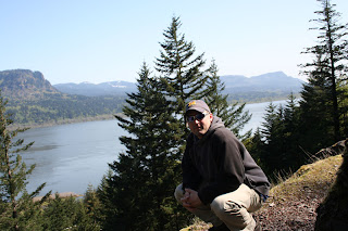
 Today I decided that I would wait until later in the summer to visit Mt. St. Helens, and opted to go explore the Columbia River Gorge area. This is a National Scenic Area approximately 30 miles east of downtown Portland, along the Columbia River. There are more than 50 different hiking trails in this area, my first choice was Multnomah Falls. I believe I would call this the tourist trail. It is a completely paved trail that is around 2.5 miles round trip. If you take it to the top of the falls the trail goes up in elevation approx 700ft. In the first half mile, you hike up to and across Benson bridge (see picture). I thought is was a great bridge, because as you crossed you were getting sprayed from the mist of the waterfall. On the way back down, this was very refreshing. At the very top of the falls, the destination of the trail, there is a platform to stand just where the water drops over the side of the cliff and begins its free fall. It is really quite a site, and even though it is not the most naturalistic hike, the views were well worth it. So you know about this water fall, here is a little background. Multnomah Falls is the the second-tallest year-round waterfall in the nation. The water of the Falls drops 620 feet from its origin on Larch Mountain. I look forward to exploring the many other trail in this area in the future.
Subscribe to:
Comments (Atom)
